About WatsonGeo
Welcome to Watson Geographics, a company driven to deliver quality geospatial products. We are GIS practitioners dedicated to providing innovative mapping solutions to the environmental and utilities business sectors.
We are proud to offer a full suite of GIS (Geographic Information Science) services including: map production, custom tool development, process automation (scripting) and geo-spatial analysis and modeling. Past projects have ranged from utilities asset management, environmental mitigation and design, biological research and non-profit humanitarian efforts. Visit the Our Services section below for further detail of how we might complement your organization.
Our Services

Map Production
Our mission is to create beautiful and effective visualizations that provide your project greater clarity and meaning. We have developed numerous map templates that can be easily adapted to fit your needs all while maintaining the feel of a custom and proprietary product.

Custom Tools
Utilizing Python programming and integrated developer environments' we are capable of automating complex and costly mapping operations. By integrating these tools into user friendly tool interfaces these scripts can be deployed across teams and or entire organizations.

Spatial Analysis
The exploration of proximity and pattern often lead to some of the most telling interactions. WatsonGeo utilizes techniques in spatial analysis to identify these relationships and make sense out of location. Examples include habitat modeling, risk assessment and environmental impact modeling.
Our Work
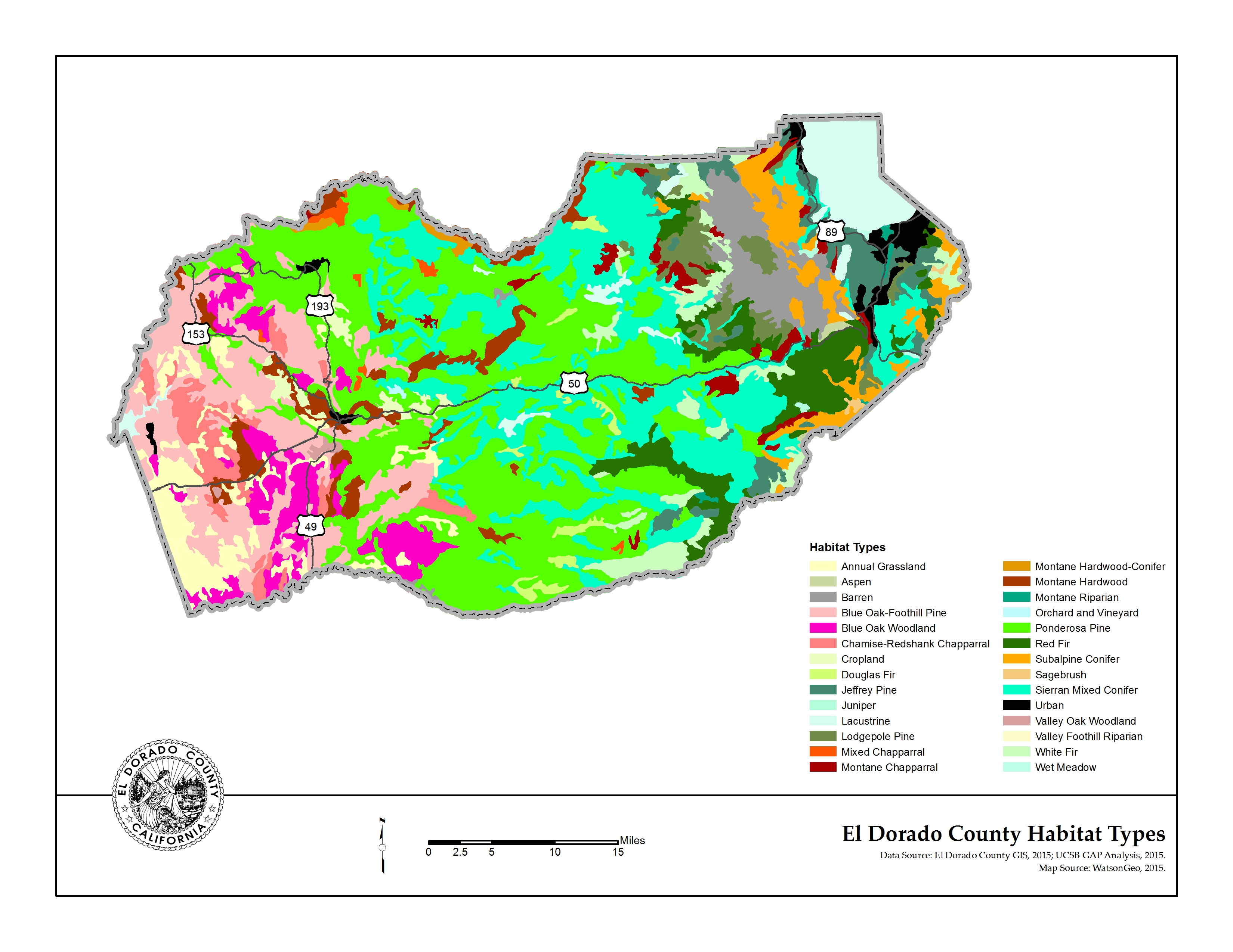
While print and digital maps are only one facet of GIS, their utility in many projects is tremendous. One simple figure can often more effectively communicate a study's findings than numerous pages of well worded text or complex tables and charts. These data rich maps are often indispensable when conveying project information with in-house staff, contractors, clients, regulatory agencies and/ or the general public.
For this reason, WatsonGeo has dedicated a great deal of time and energy to develop attractive and effective map templates that are solely focused on communicating your projects' content. These templates have been specifically designed with simplicity and beauty in mind and aim to add to the professional appearance of your project documents. Best of all, the WatsonGeo team is ready to develop new designs driven by your specific direction and taste. If you have a map in mind, let's work together to bring it to life.
Say Hello!
We are thrilled that you have visited our site and look forward to speaking to you regarding the various ways that we might serve your organization. Please feel free to contact us regarding consulting opportunities, collaboration and or general industry buzz.


